During summers, social media is packed with images of teachers, students, and parents traveling near and far. Many trips show amazing destinations, either long or short in length. No one shares photos of a paper map or their list of directions. Mapping skills, as seen in movies like Indiana Jones and National Treasure, are an afterthought for students. Today’s explorers are accustomed to online mapping tools like MapQuest or Google Maps.
Newer technologies make map reading easier for students and adults alike! Having digital maps at their fingertips, our students may question traditional mapping activities or lessons. There are a few ways educators can implement engaging mapping skill practice for learners and integrate technologies at the same time.
Visual Impact
Introducing students to mapping skills should be relevant to students lives, not a difficult or boring task. The Miacademy Learning Channel gives students an entertaining overview of map skills, the history of mapping, and why it is important to be able to read and interpret a map. National Geographic also has a library of resources for teachers that includes lessons varying from map cartography to map use for tracking temperature or historical events. Maps are more than locations and directions. They give us a visual for organizing information and comprehending data.
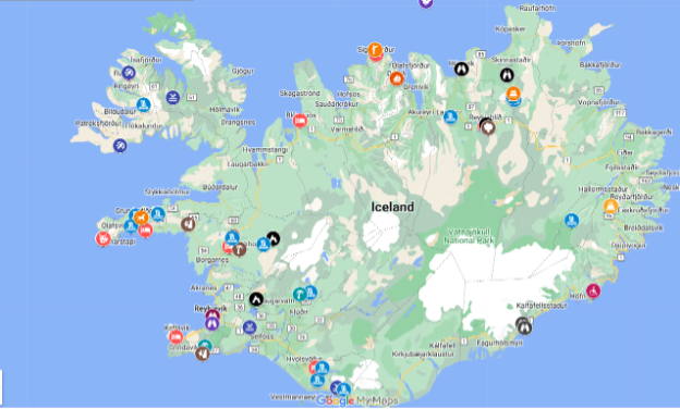
Personally, our family used Google Maps to help us create an itinerary for a trip to Iceland. The map included links to information about the area and even ticket and tour information.


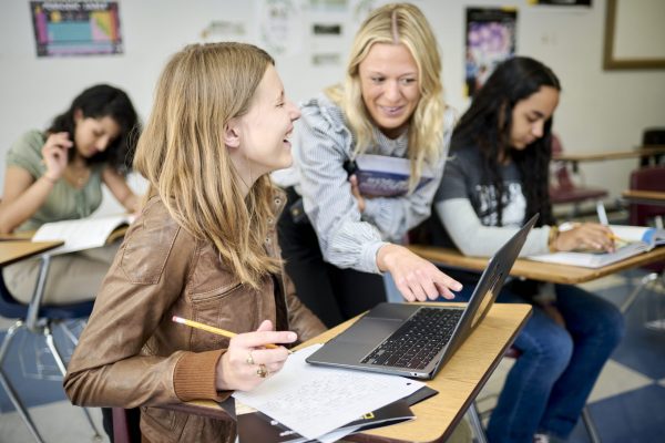
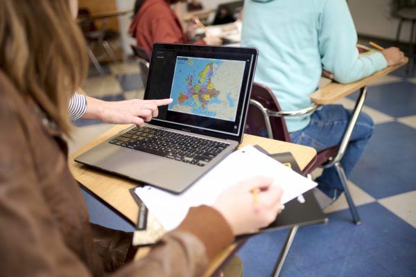
Building map skills is engaging and interactive for students when using the latest technology tools, as students can see an immediate impact in their own lives. Google Maps allows students to pin various locations and create itineraries for a trip, bucket list, or a project in class. Teachers may direct students to map out historical events or track weather temperatures in each area related to a lesson. Science, math, literacy, and social studies integrated with technology like Google Maps, gives students a purpose for learning mapping skills.
As a collaborative activity, students can track the migration paths of animals by adding information to the map as they find credible data sets to back up their mapping projects. A teacher may choose to focus less on students learning latitude and longitude with a focus on analyzing trends or patterns in an area.

Fact Checking with Data Science
Technologies now give students faster data sets for analyzing trends and patterns among humans or the environment. A push in recent years involves data literacy with a student’s ability to analyze information in a text. This skill must be practiced in all subjects daily if students are going to be proficient in analyzing data in their future careers. Students practice annotating literacy texts, pulling main ideas, supporting details, and author opinions or bias out of the text. Social studies teachers can support literacy practice by curating opportunities to analyze data sets and discuss patterns or trends. Students learn how to read data sets and back up their opinions for interpreting the information in a certain way.
National Geographic Learning provides educators with many options for using map skills with students in a creative way. The resources even include a lesson involving mapping movies through art.
Mapping in Fantasy Worlds
The Internet is full of fictional maps from worlds found in novels and books. This Mapping Movies Through Art activity gives students a creative way to analyze movies, practicing sequencing and geography in a different way. Students create nonlinear maps through graphics and art. Students can take the mapping activity further by looking at various maps of imaginative worlds from movies and books. The Fandom website gives teachers and students an interactive map of the Star Wars galaxy. Students can use the map to practice geography and mapping skills. The map includes pins with various location details on it. Students can create stories using the details within the map.
Educators can integrate literacy and mapping skills into the Social Studies curriculum, giving students engaging experiences. Students can create their own maps of their favorite stories or stories they are currently reading. Online samples may allow students to focus on a map design strategy for a text. The continued practice with mapping skills now integrated with literacy strategies increases student engagement and retention.
The options are endless for students involving mapping skills! With a click of a button, teachers have instant activities that benefit students in and out of the classroom.
Be sure to check out National Geographic’s MapMaker tool and learn about Esri’s GIS StoryMaps for your classroom.
References
ArcGIS Online [n.d.]. [Home page]. Retrieved from
https://ngl-k12.maps.arcgis.com/home/index.html
MapQuest. (n.d.). [Website]. Retrieved October 4, 2024, from
https://www.mapquest.com/
Miacademy Learning Channel K-8 [YouTube channel]. Retrieved October 4, 2024, from
https://www.youtube.com/@MiacademyLearningChannelK-8
National Geographic. (2014, March 17). Maps, movies, and cinema: Illustrations that have shaped our world [Feature story]. National Geographic.
https://www.nationalgeographic.com/culture/article/maps-movies-cinema-illustrations-star-trek-princess-bride-jurassic-park?rnd=1721738161893&loggedin=true
Star Wars Fanon [Wookieepedia]. (n.d.). Map: Map of the galaxy. Retrieved from
https://starwars.fandom.com/wiki/Map:Map_of_the_galaxy
More About the Author
Dr. Amy L. Holland is a seasoned educator with nearly two decades of experience shaping young minds. Her passion for learning has led her to teach across various levels, from elementary and middle school to the collegiate realm. With a diverse background encompassing both humanities and social sciences, Dr. Holland currently dedicates her time to inspiring junior high students through history while also mentoring future educators in the innovative use of technology in the classroom at the graduate level. Beyond the classroom, Dr. Holland finds joy in the written word and exploring the world through travel. She resides in Gravette, Arkansas, with her husband and two teenage children. Their shared love for horses has led them to establish a small equestrian facility, offering riding lessons and the therapeutic benefits of equine companionship.
